How do: Equations work
Equations are a key part of the IGI software family. Here we explain how they work...

Product Owner
p:IGI+ makes importing, filtering, exploring and visualising sample data simple. Integrating advanced tools you can quickly provide consistent, reproducible interpretations.
Equations are a key part of the IGI software family. Here we explain how they work...
Product Owner
IGI is pleased to announce its 2024 annual user group dates. This will be an in-person event again this year staying in the Devon countryside at Hallsannery House. The event will run from the 25th to 26th of June, with arrival from the 16.

Office Manager
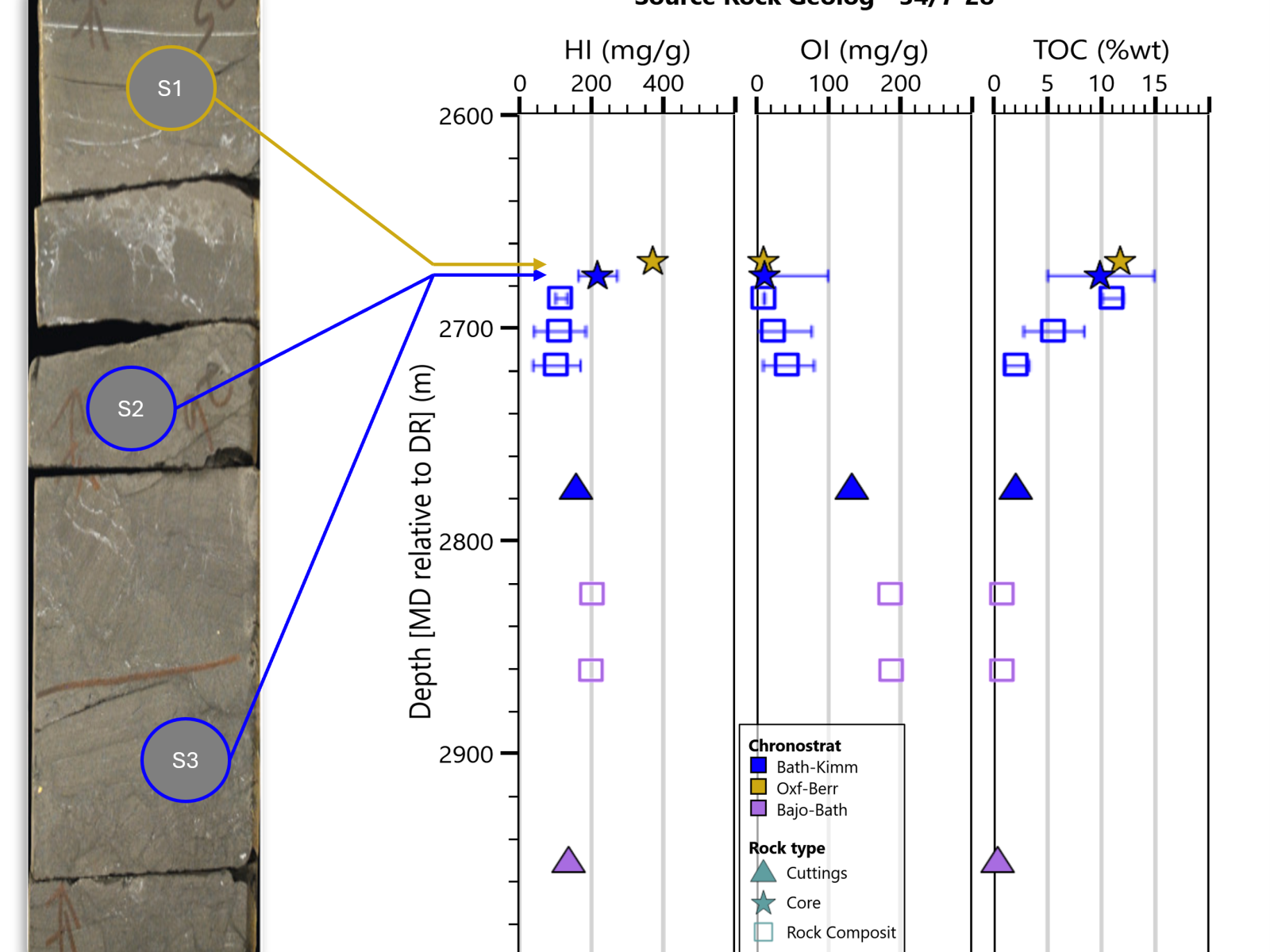
Many of our software users will have noticed that the release of p:IGI+ V2. 3 saw the removal of the pre-made Analysis and Interpretation page artefacts.
Office Manager
Product Benefits
Increase productivity using a product customised to the petroleum geochemistry domain. Organise data effectively, especially when twinned with IGI’s ‘Metis’ centralised geochemical database.
High-resolution output aids the delivery of results to colleagues and management. p:IGI+ promotes consistency that drives fast comparisons between different datasets, plays or prospects.
Base decisions on predefined data views based on publications, taking advantage of explanations when twinned with IGI’s ‘ig.NET’ online geochemistry resource.
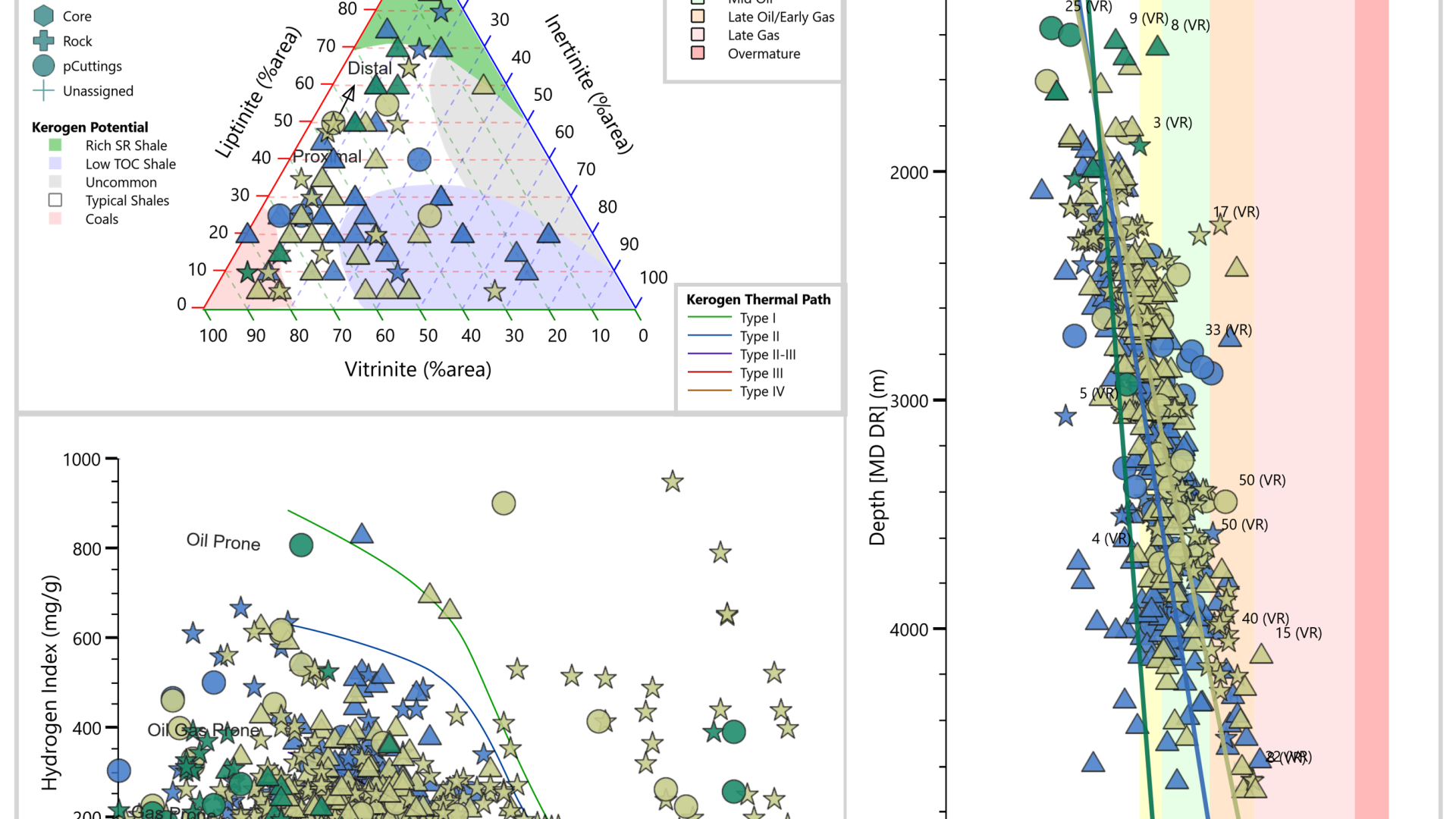
Graphs, palettes, maps and other data views assist users and companies to rank and de-risk at well, field, basin or regional scale.
Explore data efficiently through predefined graphs with industry-standard overlays.
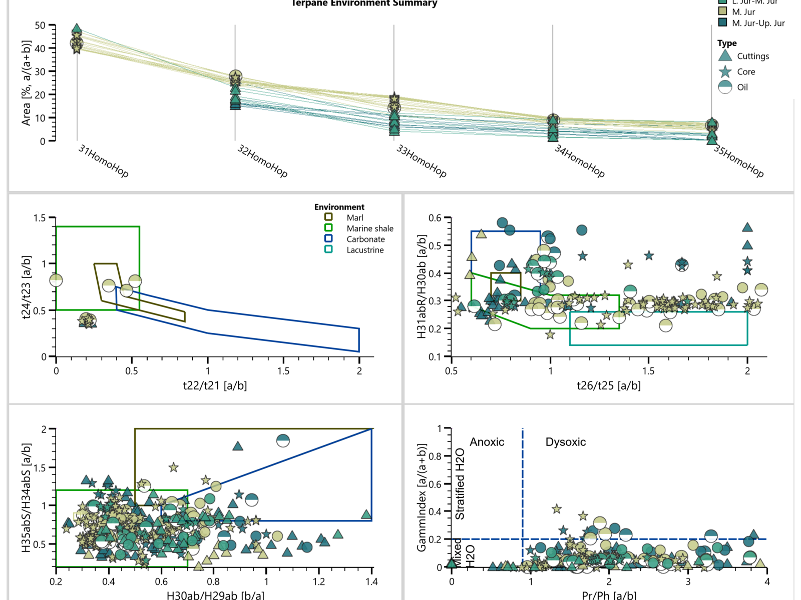
Follow a data-driven approach, using integrated data science methods, to identify relationships in data and discover trends and outliers.
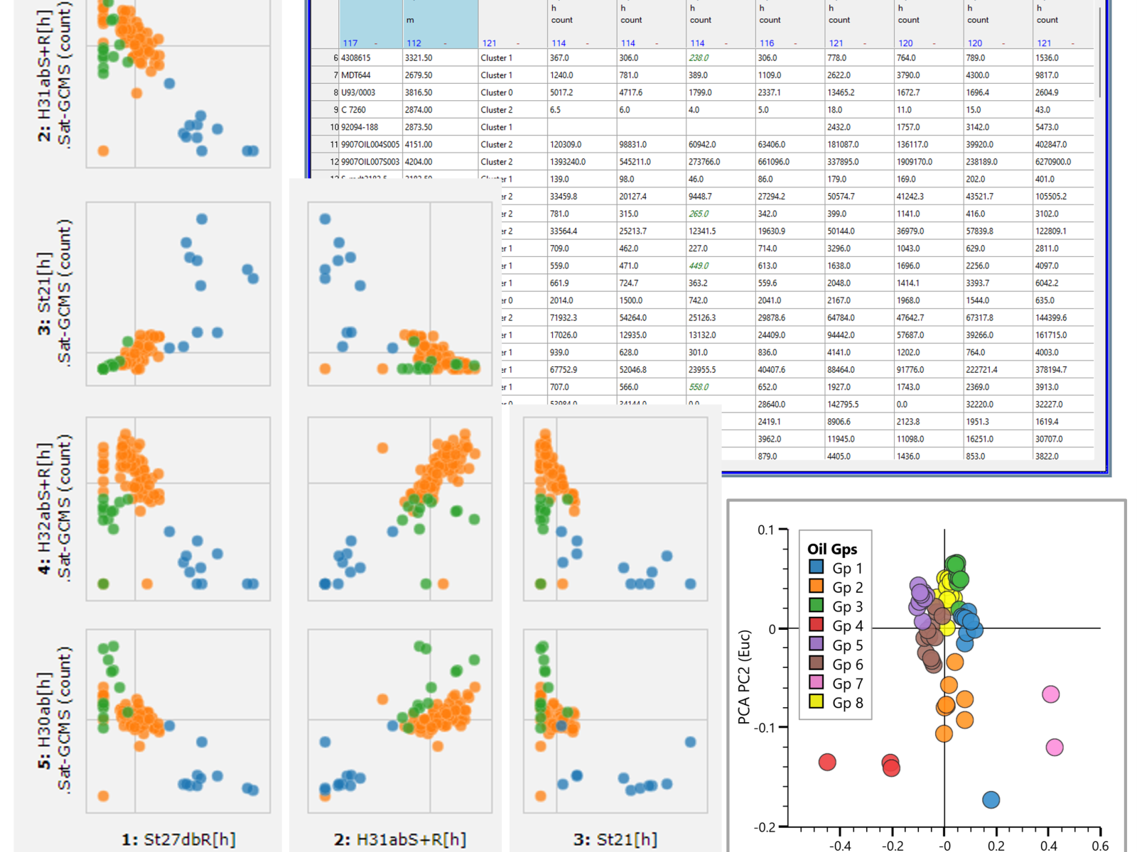
Integrated maps, statistical summaries and graphs enable you to contextualise your understanding of complex relationships across many variables.
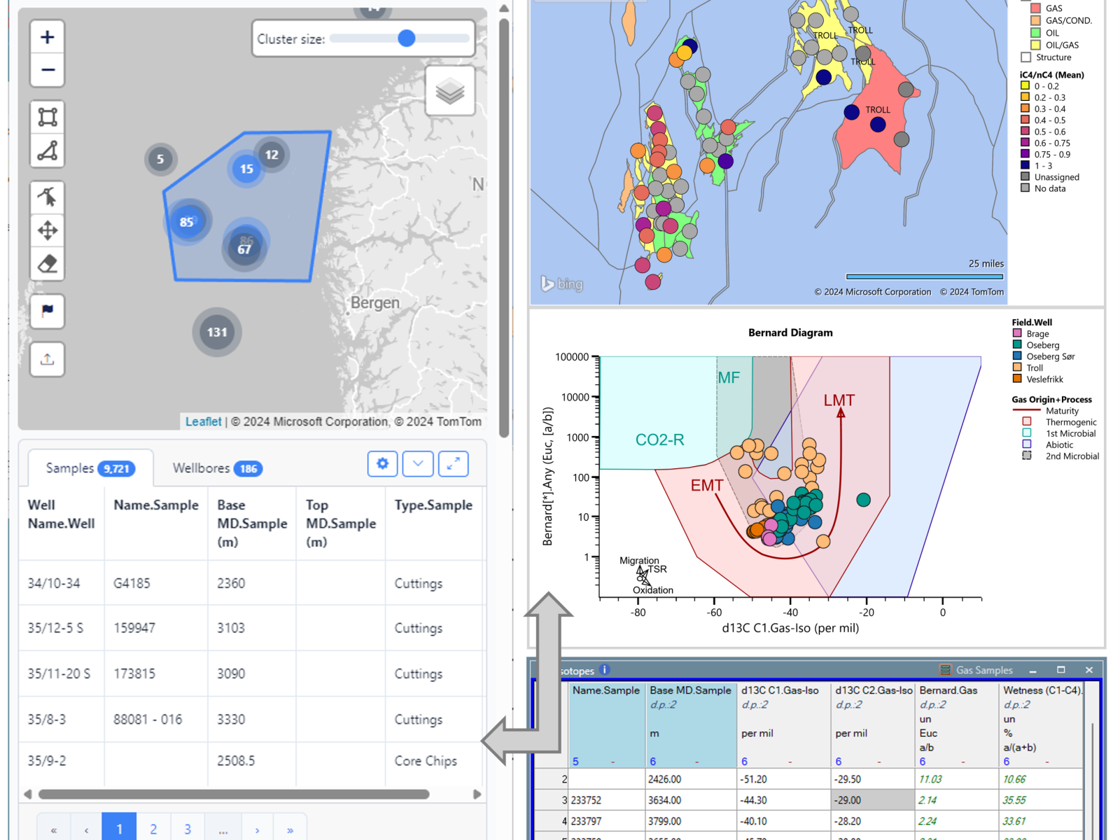
Efficiently import, quality control, edit, gap-fill and collocate your data to get the most value from what you have measured.
“I’ve been using p:IGI+ to serve project purposes of both industry and academic environments, and I can admit it is super handy. Visualizing data, fast and rigorously considerably benefits my overall analysis and geo-interpretations. I can’t wait to see new features in the future!”